Travel chaos as rain hits West Midlands leading to weather warnings
Torrential rain has led to travel chaos for commuters as weather warnings were issued across the West Midlands.
The Met Office warned downpours would continue all through the day as it announced a yellow weather warning for rain.
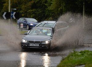
Motorists and passengers faced disruption as rain continue to fall leading to blocked drains and spray on busy routes.

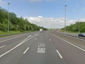
A lane on the M5 northbound, between Junction 3 for Quinton to Junction 2 for Oldbury, was closed for an hour this morning due to flooding.
It led to a series of tailbacks on delays on the stretch.
There were knock on disruption along A456 Manor Way and the A459 Grange Road in Halesowen.
And passengers were hit by a number of train delays as the weather took hold.
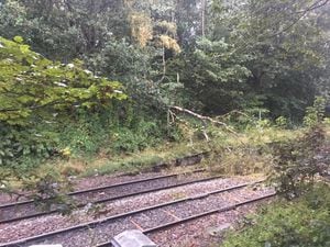
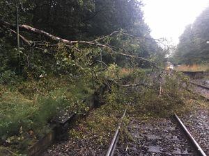
A tree blocking the railway between Smethwick Galton Bridge and Langley Green has led to disruptions until 12pm.
Trains between Birmingham Snow Hill and Stourbridge Junction are currently delayed by up to 45 minutes .
Tickets are being accepted on other railway services, bus services and the West Midlands Metro.
And rail replacement services are currently being arranged.
Temperatures are expected to hit an average of 16C (60.8F) across the Black Country and South Staffordshire.
Chief meteorologist, Neil Armstrong, said: “Many people will notice a big change in the weather this week, as last week’s warm and sunny weather is replaced by spells of heavy rain and strong winds mixed with some drier, brighter spells.
“Today will be wet across much of the UK, particularly England and Wales, where heavy rain could see 30-50mm falling in a short time and up to 70mm in some isolated spots.
"The heavy rain will be accompanied by hail, thunderstorms and gusty winds, leading to flooding and difficult driving conditions.”
It comes as the remnant of Hurricane Humberto sweeps across the nation, but the weather is expected to clear later today.
Low pressure, which could see showers amid bright and breezy weather, will remain to create an "unsettled" weekend.
Mr Armstrong added: “It’ll be an unsettled weekend as low pressure remains in charge – there are some early signals for another deep area of low pressure forming on Sunday – this in combination with high Spring tides means could bring another spell of severe weather and risk of flooding.”