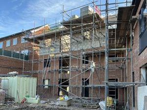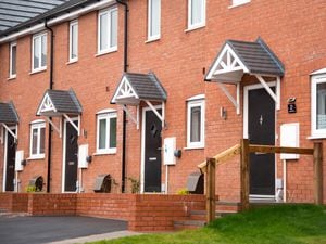
Masterplan for 2,000 homes, health centre and schools backed
A 2,000-home plan that will change the face of Stafford is set for the green light when it goes before planning bosses once again next week.
The outline proposals for land north of Beaconside that includes two new schools, an “elderly living facility” with up to 60 beds and a health centre, is back before Stafford Borough Council planners next Monday.
The Maximus Strategic Stafford LLP proposal has been recommended for approval, subject to conditions by council officers, two months after a decision was delayed over flooding fears at a council special meeting in November.
At that meeting it was described as the "biggest housing development that is going to be happening in Stafford Borough" with councillors saying they needed more time to make a decision.
Now new information has since been submitted with flood mitigation proposals, which outline measures to alleviate risk of flooding both to the development and downstream in areas like Sandon Road, which has been hit by flooding problems in the past.
The case officer John Holmes says in a report going to the meeting: "The proposal is in accord with the government’s objective of significantly boosting the supply of homes.
"The planning balance therefore must consider the positive of a significant boost to the supply of housing in Stafford including the provision of some affordable housing."
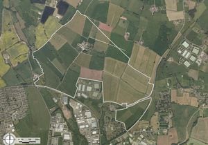
The plans for the 143 hectare site north of Beaconside were first submitted to Stafford Borough Council in late 2016.
Alongside the 2,000 new homes outline permission is being sought for a two form entry primary school, five form entry secondary school, two “local centres” to provide retail and business space, an “elderly living facility” with up to 60 beds, a health centre, a park, sports facilities, community gardens and roads.
The site covers an area of about 143 hectares and is located to the north of Stafford, about 3km from the town centre.
The site is to the east of Marston Lane, and north of the A513, with Sandon Road running between the two parcels of the site.
It is currently mostly agricultural fields.