
Snow and ice weather warning for West Midlands as temperatures fall
Severe weather warnings for snow and ice have been upgraded as wintry conditions sweep into the West Midlands.
Forecasters have revised their predictions for wintery weather to return to the Black Country, Staffordshire and parts of Worcestershire overnight.
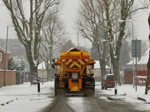
Treacherous driving conditions have already hit parts of Scotland and the snow showers are set to head south over the coming hours.
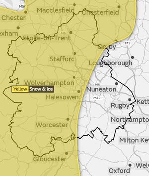
The Met Office has now issued yellow warnings for snow and ice for parts of the Midlands.
Temperatures will drop to 0C (32F) in towns and cities overnight.
The Met Office said: "Showers are falling as sleet, snow and hail already in the north of the warning area, and this threat spreads to parts of Wales, the Midlands and southern England on Tuesday evening and overnight into Wednesday.
"The warning has been extended further south and east to cover small amounts of snow, for example in parts of southern England.
"Delays to travel are possible, with a lower likelihood of cancellations of public transport.
"Some roads and pavements will turn icy, with an increased likelihood of some accidents and injuries."
WATCH the latest weather forecast
A snow and ice warning is in place for these areas, with 2cm-6cm of snow expected over the hills and 1cm-2cm at lower levels.
Showers are expected to continue into the night with wintry falls on Wednesday, especially across the north of the region.